
|
|
|---|
![]()
![]()
On December 14th, an eclipse1 of the Sun will be visible from much of the Americas and the Pacific Ocean. From some locations, more than 96% of the Sun's disk will be hidden by the Moon. The eclipse will be partial for most observers throughtout this region including the United States (except New England), southern Canada, Mexico, Central America, the Caribbean, northern South America and the Pacific Ocean. A global map of Earth shows the exact region of eclipse visibility (outlined in red). This global map is also available in Medium Resolution and High Resolution versions.
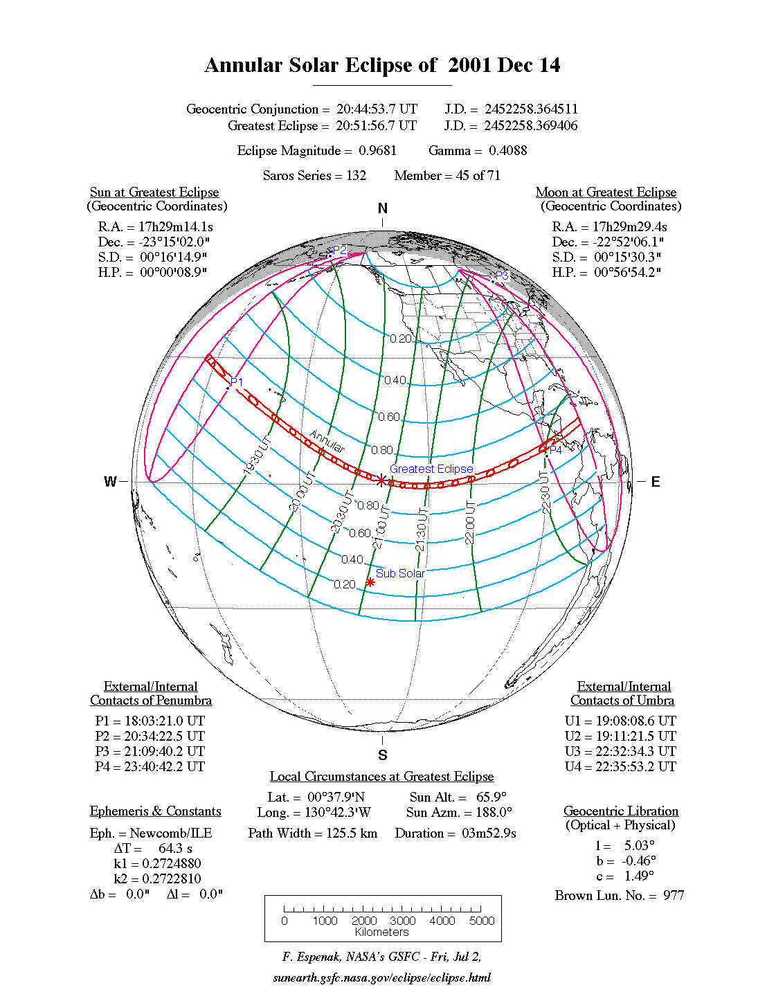
This eclipse is actually a special kind of partial eclipse called an annular eclipse. During an annular eclipse, the Moon passes directly in front of the Sun but is unable to completely cover it because the Moon's disk appears smaller than the Sun. The annular phase of the eclipse can only be seen from a very narrow track called the path of annularity. Although December's annular path is nearly 13,000 kilometers long, it is only 124 to 177 kilometers wide. The path of annularity is plotted in blue on the global map of the eclipse (also available in Medium and High resolution).
The annular path begins at 19:08 UT2 near the International Date Line approximately 3000 kilometers northwest of the Hawaiian Islands. Unfortunately, the path misses the island chain and passes about 500 kilometers to its south. Still, the islands enjoy a deep partial eclipse with a magnitude3 exceeding 0.8.
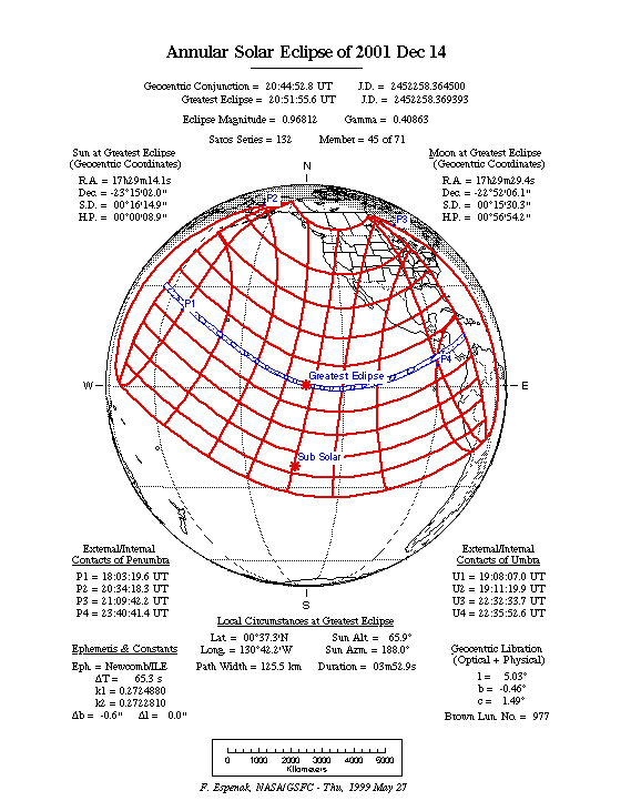
Traveling along a southeastern track, the annular path begins curving northward as it reaches the Equator. Greatest eclipse4 occurs at 20:51:56 UT just half a degree north of the Equator. The duration of the annular phase will last for 3m53s, but the event takes place in open ocean with no landfall in sight.
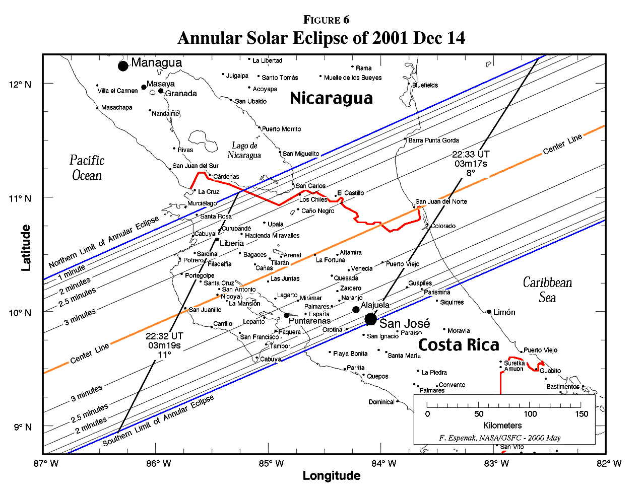
As the annular path swings to the northeast, it finally makes its only major landfall as it quickly crosses the Central American nations of Costa Rica and Nicaragua. A detailed map shows the path limits and centerline5 through these countries. Mid-annularity occurs along the Pacific coast of Costa Rica at 22:32 UT during the late afternoon. The Sun will stand 11° above the southwestern horizon during an annular phase lasting 3m19s. The corresponding eclipse magnitude and obscuration (fraction of Sun's surface) will be 0.956 and 0.915, respectively. Costa Rica's capital city of San Jose actually lies just inside the southern limit where mid-annularity occurs at 23:33 UT.
Several minutes later, the path ends at sunset in the Caribbean at 22:35:53 UT. Over the course of 3 hours and 28 minutes, the Moon's annular shadow travels along a path approximately 12,900 kilometers long and covering 0.4% of Earth's surface area. A Table of Coordinates lists the geographic coordinates of the annular path along with the Sun's altitude and azimuth, the path width and the duration of annularity on the centerline.
|
|---|
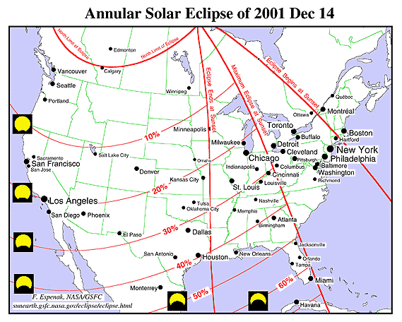
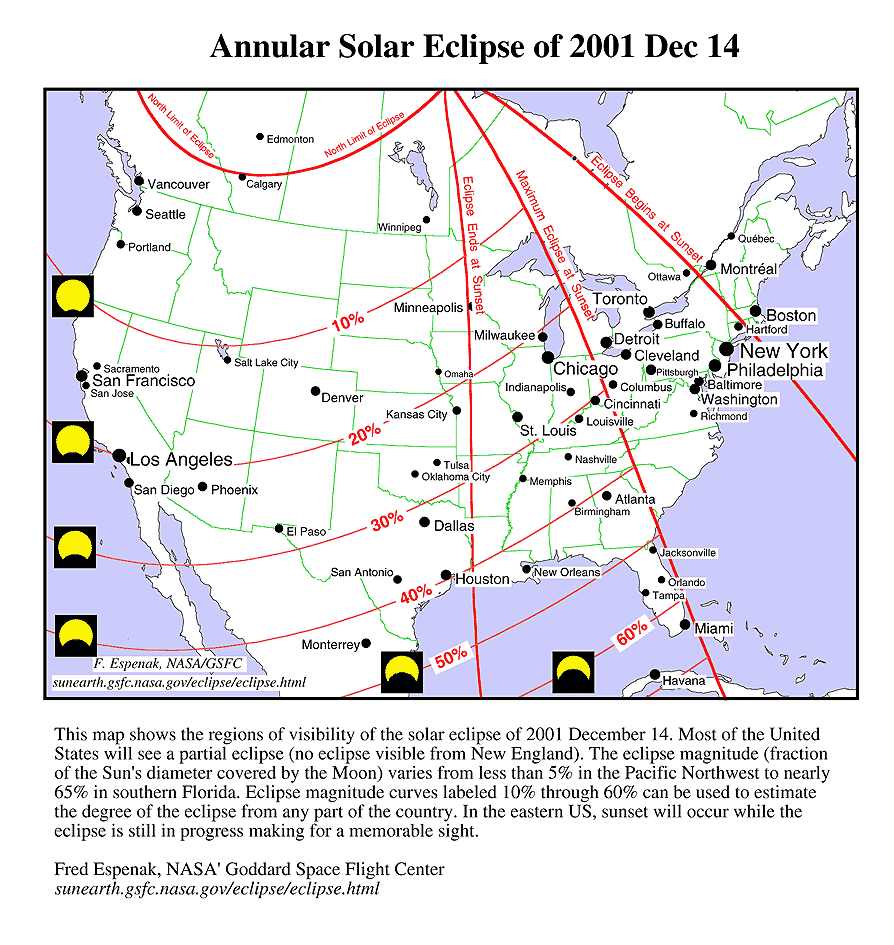
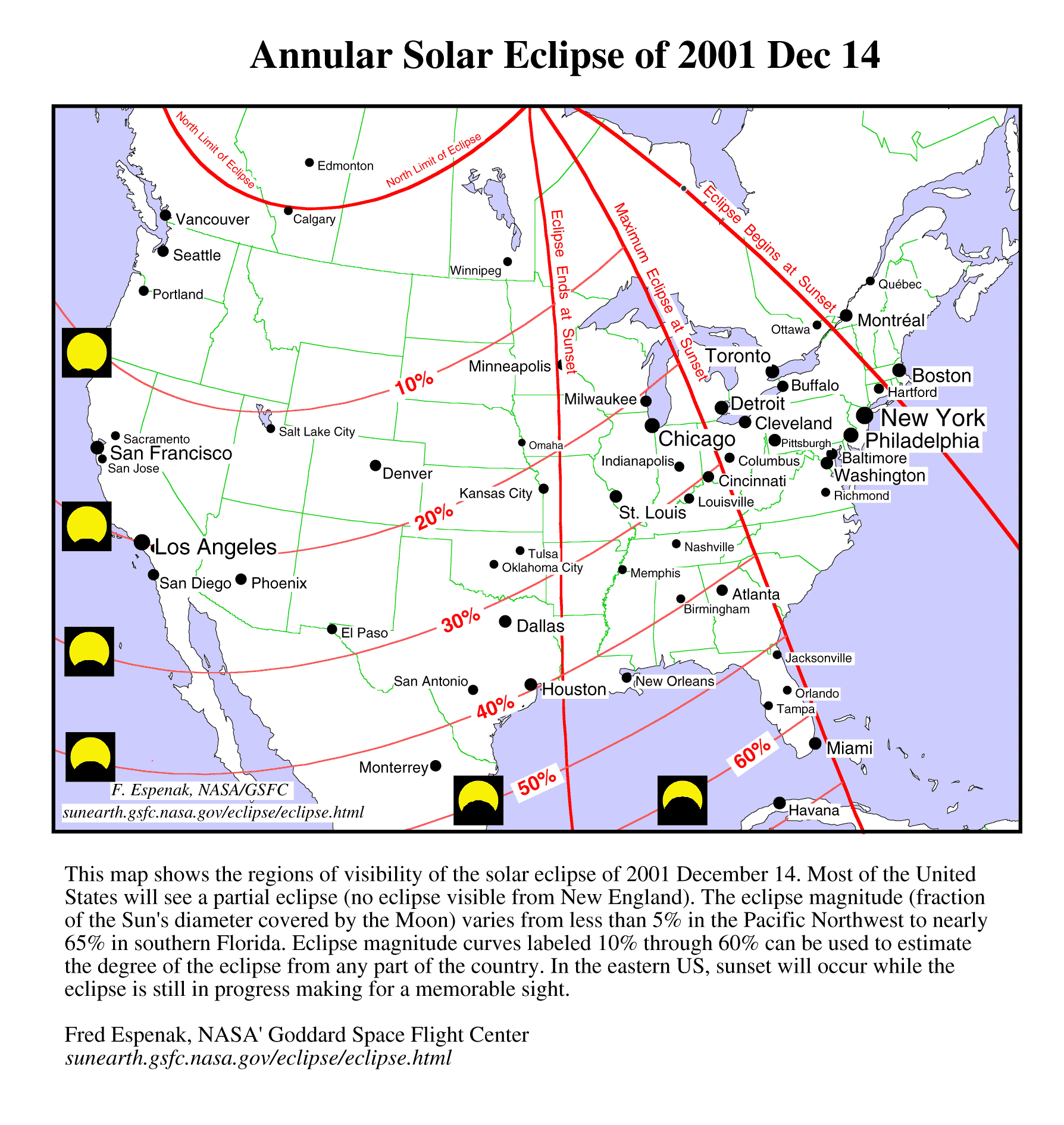
This map shows the regions of visibility of the solar eclipse of 2001 December 14 in the USA and southern Canada. Most of the United States will see a partial eclipse (no eclipse visible from New England). The eclipse magnitude (fraction of the Sun's diameter covered by the Moon) varies from less than 5% in the Pacific Northwest to nearly 65% in southern Florida. Eclipse magnitude curves labeled 10% through 60% can be used to estimate the degree of the eclipse from any part of the country. In the eastern USA, sunset will occur while the eclipse is still in progress making for a memorable sight.
This map is also available in Medium Resolution and High Resolution versions.
Outside of the narrow annular path, a partial eclipse will be seen from a much larger geographic area. The zone of partial eclipse extends approximately 4000 to 5000 kilometers north and south of the annular path and includes much of North America (except the northeast), Central America and northern South America. The global map of Earth shows the exact region of eclipse visibility which is outlined in red (also available in Medium and High resolution). For North Americans, the eclipse magnitude3 decreases the further north you travel.
In Texas and the southeastern states, the eclipse magnitude ranges from around 0.3 to 0.5 (30% to 50%). In comparison, southern Florida will see an eclipse with a magnitude of over 0.6. This is the largest eclipse magnitude in the continental USA (Hawaii will see an eclipse with a magnitude of 0.84). The American mid-west and southwest will see an eclipse magnitude of around 0.2, while the northwest and southern Alaska will see 0.1 or less.
Most of southern Canada will also see a small eclipse of magnitude 0.1 or less. The exception is the southern Ontario area where the magnitude will be as large as 0.22.
The partial eclipse takes place in the early afternoon from the western USA. For observers in the middle section of the country, the eclipse occurs in mid to late afternoon. In the east, the eclipse is in progress at sunset.
Extreme care must be taken when watching the solar eclipse. You should visit a web site which discusses a number of ways to Safely View the Eclipse. The eclipse itself is no more dangerous to view than the Sun is on any other day. The only difference is that human curiosity impels some people to stare directly at the Sun during an eclipse and this is can cause permanent damage to your eyesight. Never look directly at the Sun with the naked eye or through any optical device (e.g. - camera, binoculars or telescope). There are a several types of Solar Filters designed specifically for Sun viewing which are available from a number of filter manufacturers and distributors. You can also use the pinhole projection method to safely watch the eclipse.
1 An eclipse of the Sun can only take place at New Moon, and only if the Moon passes between the Sun and Earth. Under these conditions, the Moon's shadow sweeps across a portion of Earth's surface and an eclipse of the Sun is seen from that region. For more information on the what, why, how, when and where of solar eclipses, see the special web site solar eclipses for beginners.
2 UT or Universal Time is the time system that astronomers use to describe and measure astronomical events like eclipses. UT is often referred to colloquially, as "Greenwich Mean Time" (GMT). For more information, see web sites for Universal Time and for World Time Scales.
3 Eclipse magnitude is used to describe the fraction of the Sun's diameter covered by the Moon. For exaample, if one third of the Sun's diameter is hidden by the Moon, then the eclipse magnitude is 0.33 or 33%.
4 Greatest eclipse is the instant when the axis of the Moon's shadow passes closest to the center of the Earth. In other words, this is when the Moon blocks most of the Earth as seen from the Sun.
5 The centerline is the midpoint between the northern and southern limits of the annular eclipse path. The annular phase lasts longest on the centerline while the duration drops to zero on the actual limits.
|
|---|
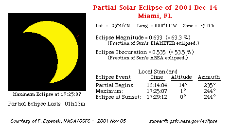
The diagram above shows what the 2001 December 14 solar eclipse will look like from Miami, FL.
The times of the start, maximum and end of the eclipse are given for Eastern Standard Time.
In this case, maximum eclipse occurs during sunset.
Eclipse times and diagrams for many other cities are found in the links below.
What will the eclipse look like and when does it begin and end? That all depends on your city or geographic location. You can see a graphic preview for a number of cities by visiting one of several special web pages and graphics prepared for the 2001 solar eclipse. Just got to the table for your country of geographic area, find your city in the table and click on it to see an eclipse diagram:
Each of the above links takes you to a table of cities listed in alphabetical order (by state in the USA). The table gives a brief summary of the eclipse circumstances as seen at each city and includes the times of start, maximum and end of the eclipse, the magnitude, the altitude of the Sun and the duration of the eclipse. As you click on the name of each city, you will see a figure illustrating the eclipse's appearance at maximum eclipse. A brief table lists the the eclipse times as well as other details about the eclipse.
An eclipse of the Sun presents a tempting target to photograph. Fortunately, solar eclipse photography is easy provided that you have the right equipment and use it correctly. Please remembr that you should never look directly at the Sun without practicing Safe Eclipse Viewing Techniques and/or use an approved solar filter!
![]()
The NASA Five Millennium Catalog of Solar Eclipses lists the date and circumstances for every eclipse from 2,000 BC through 3,000 AD. During this period, there are 11,897 eclipses of the Sun (including partial, annular and total). Slightly more than one third of these are partial eclipses, on third are annular eclipses and just over one quarter are total eclipses.
There are at least two solar eclipses every year although they may both be partial eclipses. On exrtremely rare occassions, there can be as many as five solar eclipses in one calendar year (e.g. - 1936 and 2207).
The table below lists every solar eclipse from 2001 through 2005. Click on the eclipse Date to see a map of an eclipse. Click on the Region of Eclipse Visibility to see a detailed description of an eclipse.
The Eclipse Magnitude is the fraction on the Sun's diameter obscurred at maximum eclipse. For values greater than 1.0, it is a total eclipse. For values less than 1.0, it is either a partial or annular eclipse. The Center Duration is the duration of either the total or annular phase (if any).
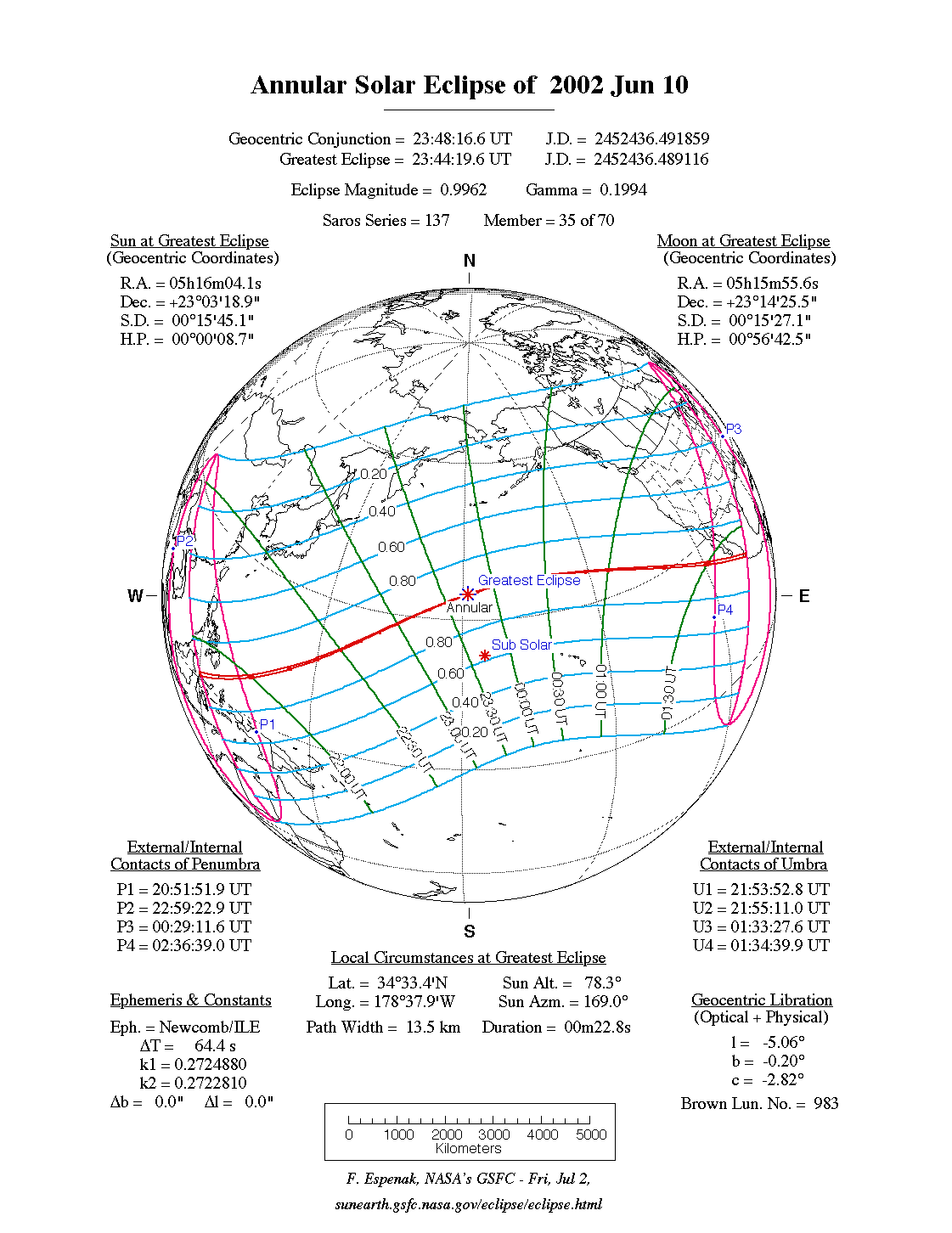
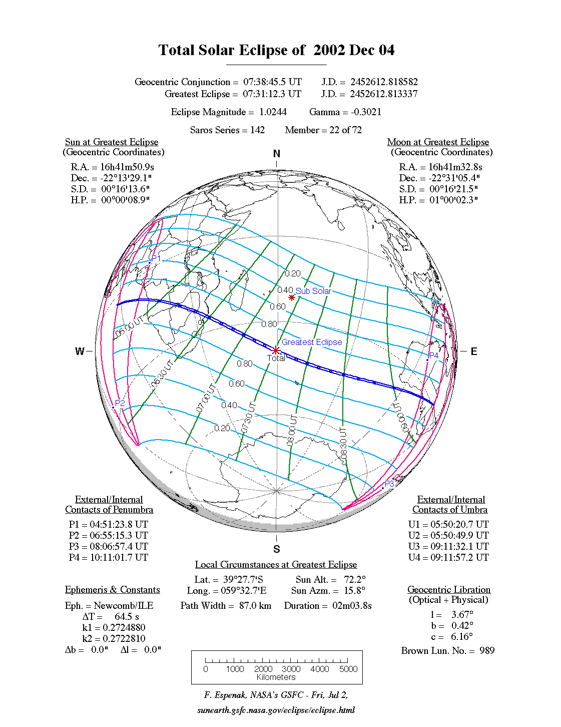
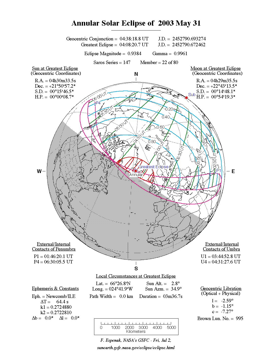
| Date | Eclipse Type | Eclipse Magnitude | Central Duration | Geographic Region of Eclipse Visibility |
|---|---|---|---|---|
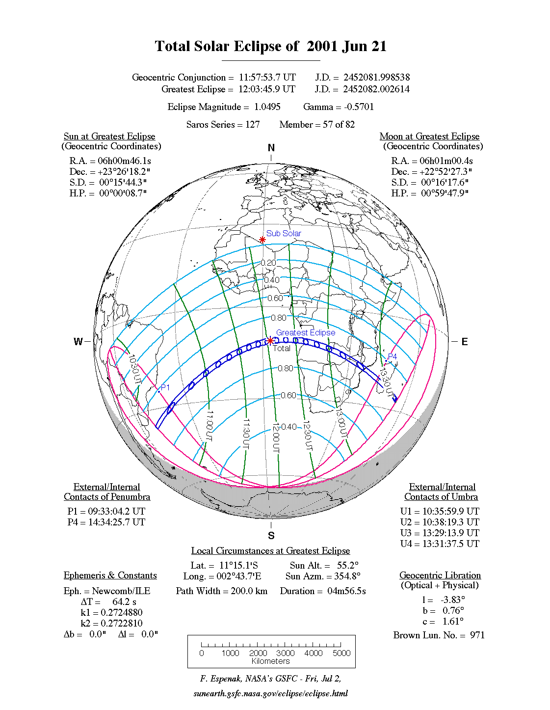
| 2001 Jun 21 | Total | 1.050 | 04m57s | e S. America, Africa
[Total: s Atlantic, s Africa, Madagascar] |
| 2001 Dec 14 | Annular | 0.968 | 03m53s | N. & C. America, nw S. America
[Annular: c Pacific, Costa Rica] |
| 2002 Jun 10 | Annular | 0.996 | 00m23s | e Asia, Australia, w N. America
[Annular: n Pacific, w Mexico] |
| 2002 Dec 04 | Total | 1.024 | 02m04s | s Africa, Antarctica, Indonesia, Australia
[Total: s Africa, s Indian, s Australia] |
| 2003 May 31 | Annular | 0.938 | 03m37s | Europe, Asia, nw N. America
[Annular: Iceland, Greenland] |
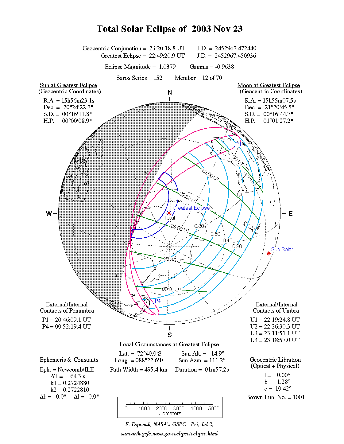
| 2003 Nov 23 | Total | 1.038 | 01m57s | Australia, N. Z., Antarctica, s S. America
[Total: Antarctica] |
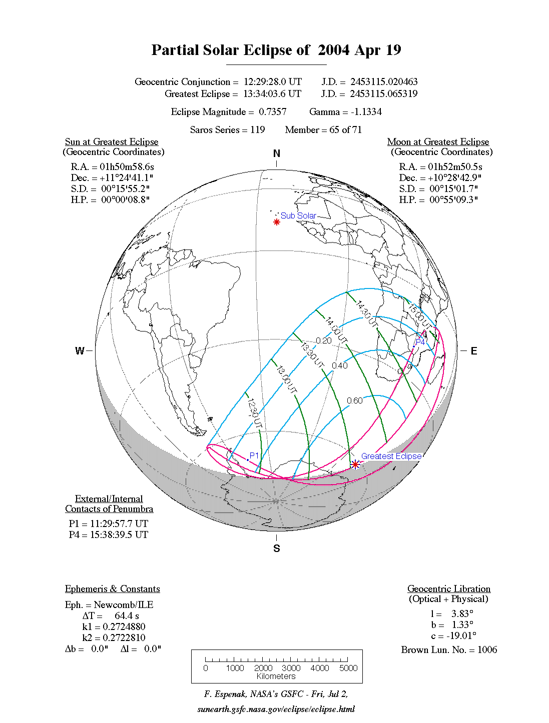
| 2004 Apr 19 | Partial | 0.736 | - | Antarctica, s Africa |
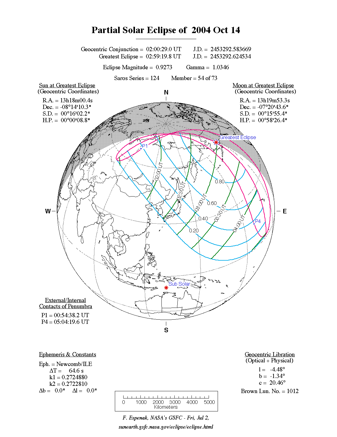
| 2004 Oct 14 | Partial | 0.927 | - | ne Asia, Hawaii, Alaska |
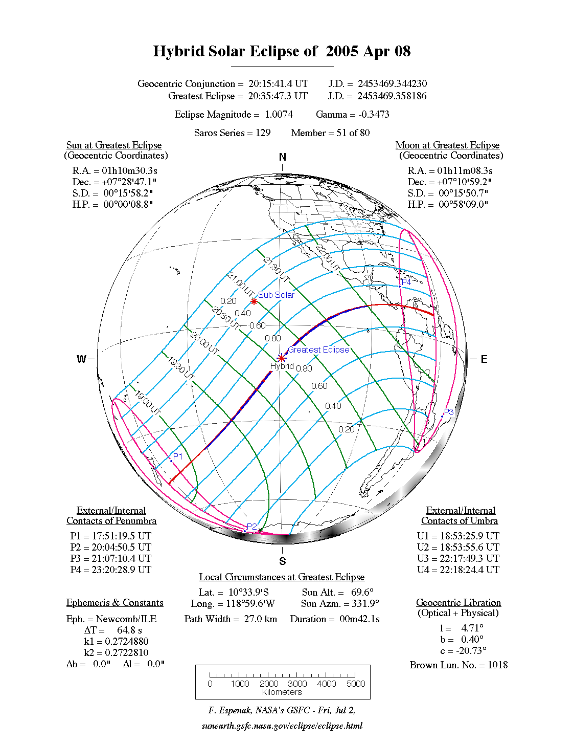
| 2005 Apr 08 | Hybrid | 1.007 | 00m42s | N. Zealand, N. & S. America
[Hybrid: s Pacific, Panama, Colombia, Venezuela] |
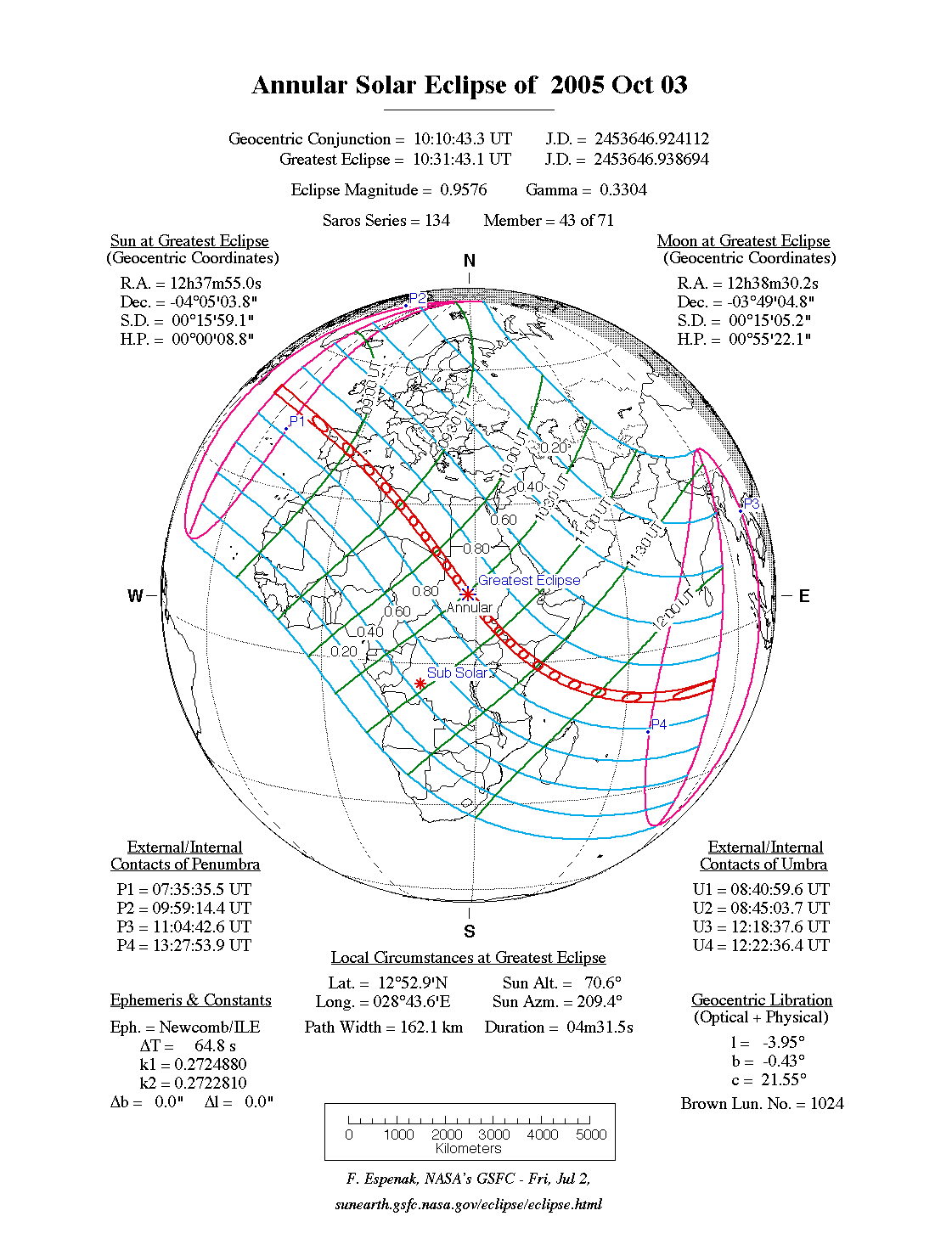
| 2005 Oct 03 | Annular | 0.958 | 04m32s | Europe, Africa, s Asia
[Annular: Portugal, Spain, Libia, Sudan, Kenya] |
Geographic abreviations: n = north, s = south, e = east, w = west, c = central
We will list links for live web coverage of the eclipse as they become available.
All eclipse calculations are by Fred Espenak, and he assumes full responsibility for their accuracy. Some of the information presented in this catalog is based on data originally published in Fifty Year Canon of Solar Eclipses: 1986 - 2035.
Permission is freely granted to reproduce this data when accompanied by the following acknowledgment:
"Eclipse Predictions by Fred Espenak, NASA/GSFC"
![]()
![]()

Webmaster: Fred Espenak Planetary Systems Laboratory - Code 693 Email: Fred.Espenak-1@nasa.gov NASA/Goddard Space Flight Center, Greenbelt, Maryland 20771 USA |
|---|
Last revised: 2003 Aug 19 - F. Espenak