
|
|---|
|
|
|---|

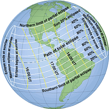
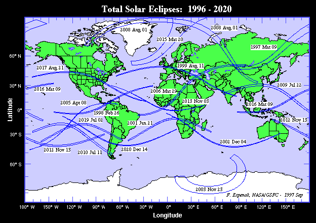
On Thursday, 1998 February 26, a total eclipse of the Sun will be visible from within a narrow corridor which traverses the Western Hemisphere. The path of the Moon's umbral shadow begins in the Pacific, continues through northern South America and the Caribbean Sea, and ends at sunset off the Atlantic coast of Africa. A partial eclipse will be seen within the much broader path of the Moon's penumbral shadow, which includes parts of the United States and eastern Canada, Mexico, Central America and the northern half of South America.
This web site has been established for the purpose of providing detailed predictions, maps, figures and information about this historic event. In addition, this site serves as a supplement to NASA RP 1383 "Total Solar Eclipse of 1998 February 26" by providing additional predictions, tables and data for this event. Some of the data posted here include an expanded version of Table 8 (Mapping Coordinates for the Zones of Grazing Eclipse), and local circumstance tables with many more cities as well as for astronomical observatories. Also featured are higher resolution maps of selected sections of the path of totality and limb profile figures for a range of locatiions/times along the path.

The following tables give detailed predictions including the Besselian Elements, shadow contacts with Earth, path of the umbral shadow and topocentric data (with path corrections) along the path. Also included are special extended version tables of path coordinates and graze zones in formats convenient for plotting on maps.
The following maps show the overall regions of visibility of the partial eclipse as well as the path of the total eclipse through several large geographic sections.
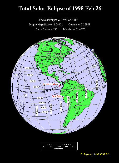
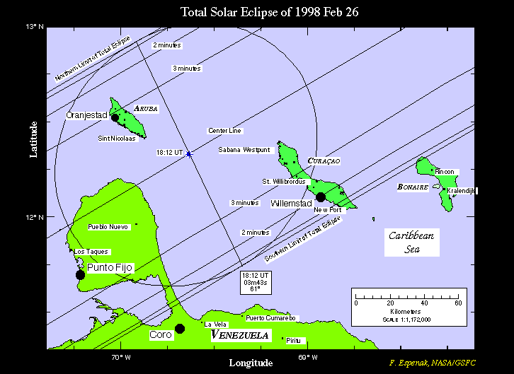
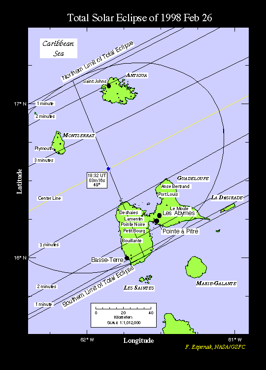
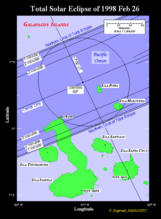
These maps are based on figures from NASA RP 1383 "Total Solar Eclipse of 1998 February 26".
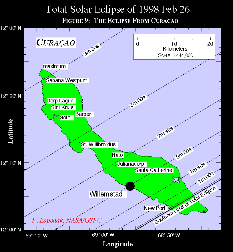
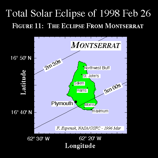
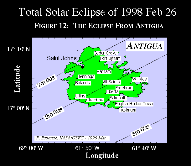
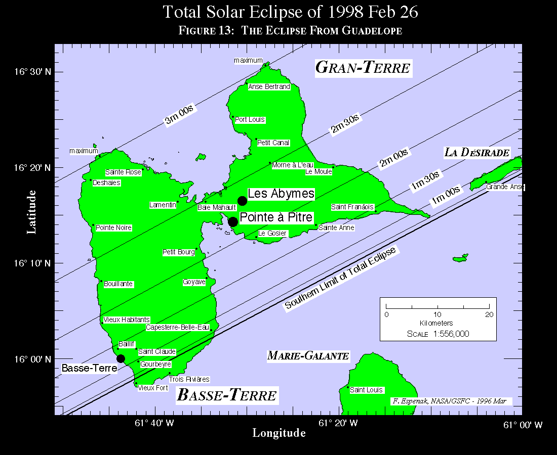
The path of totality has been plotted via custon software onto maps using a simple equidistant cylindrical projection scaled for the central latitude of each map. They all use high resolution coastline data from the World Data Base II (WDB) and World Vector Shoreline (WVS) data. These maps were chosen to isolate major islands in the Galapagos and the Caribbean which lie within the eclipse path. Curves of maximum eclipse and constant eclipse magnitude are included as well as the outline of the umbral shadow. A special feature of these maps are the curves of constant umbral eclipse duration (i.e., totality) which are plotted within the path. These curves permit fast determination of approximate durations without consulting any tables. Furthermore, city data from a recently enlarged geographic data base of over 90,000 positions are plotted to give as many locations as possible in the path of totality.
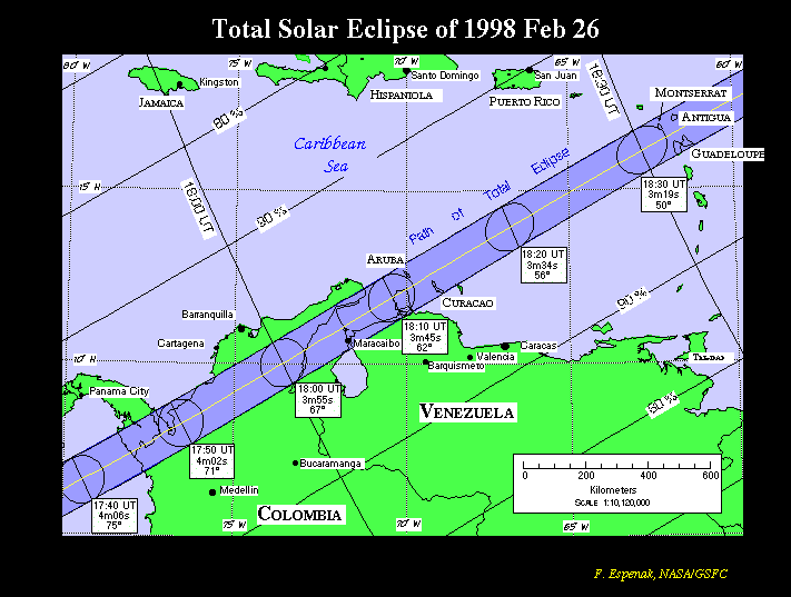
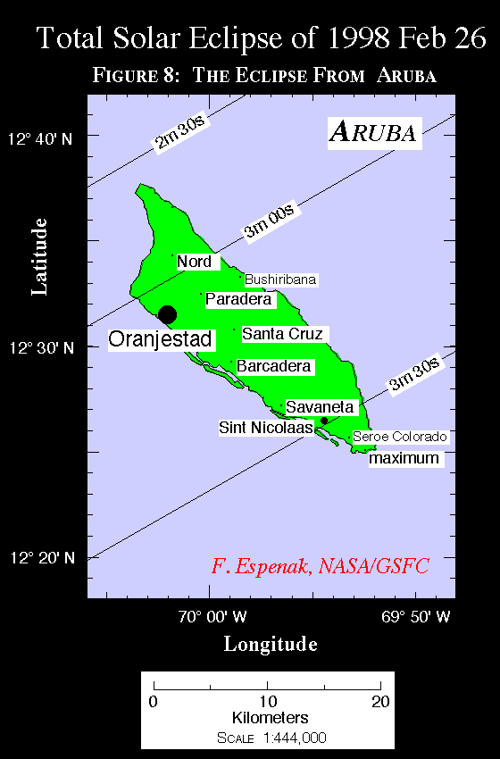
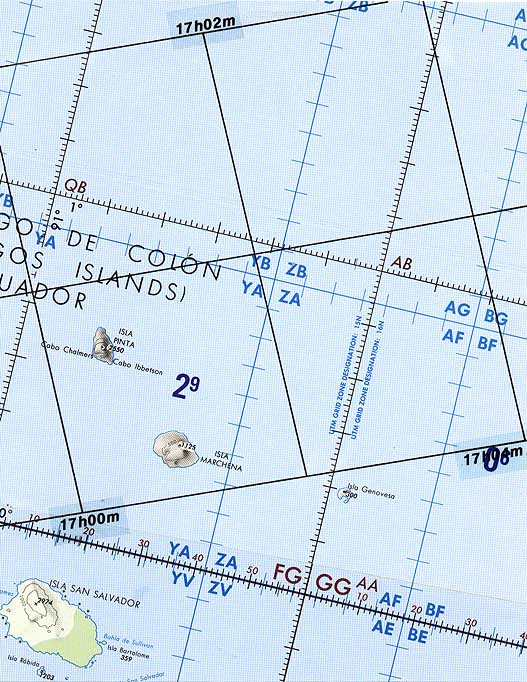
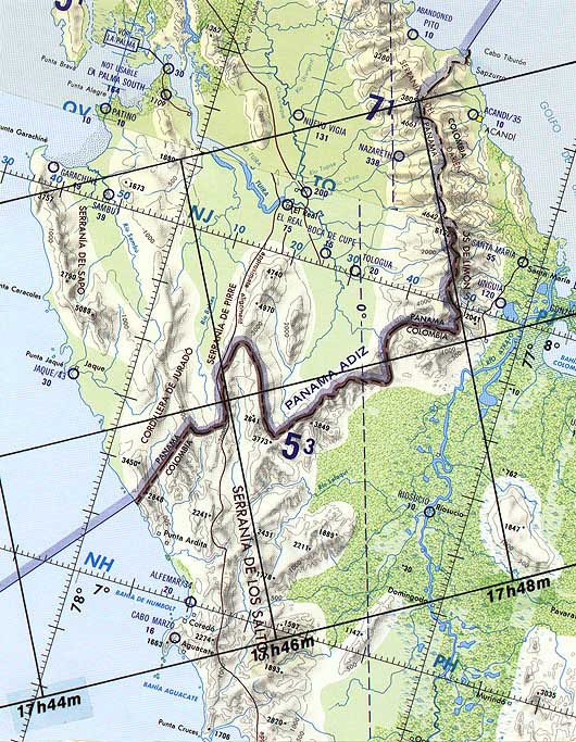
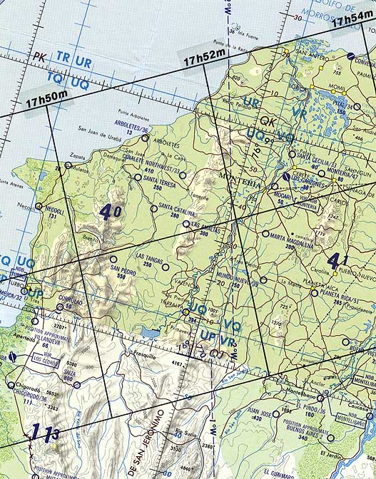
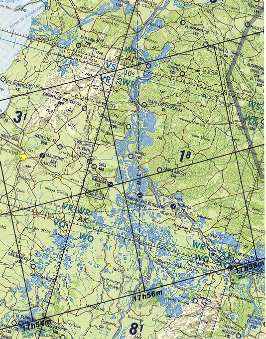
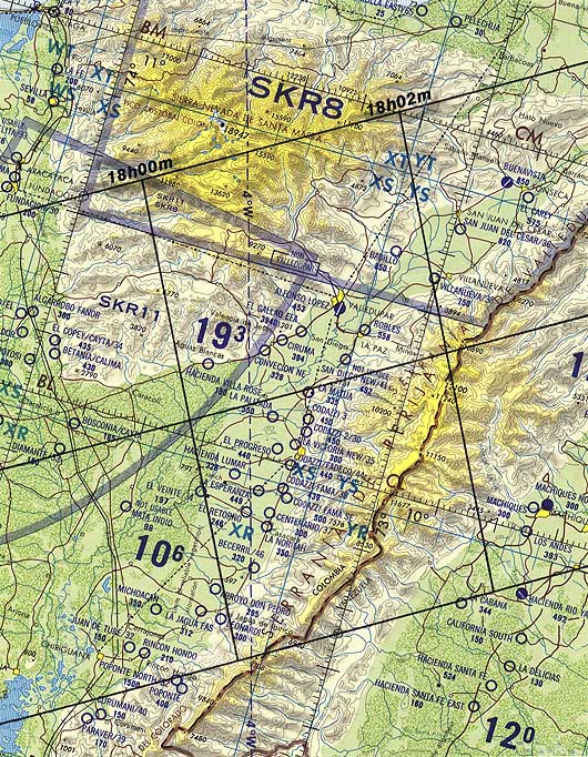
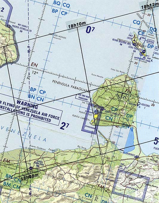
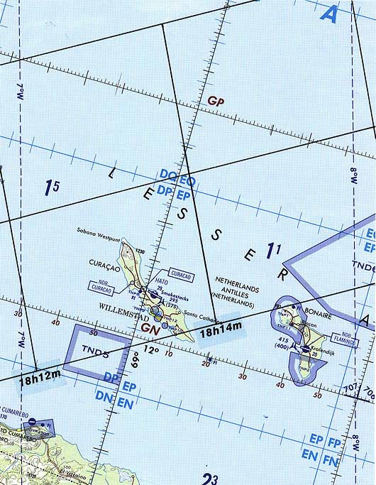
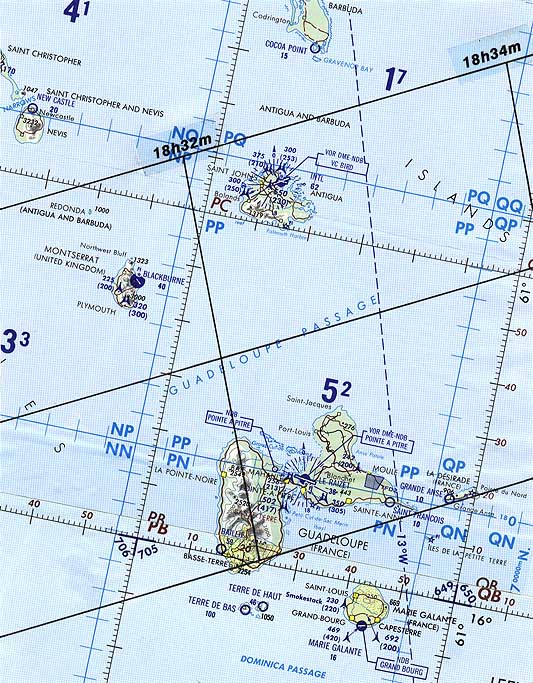
These maps are adapted from NASA RP 1383 "Total Solar Eclipse of 1998 February 26".
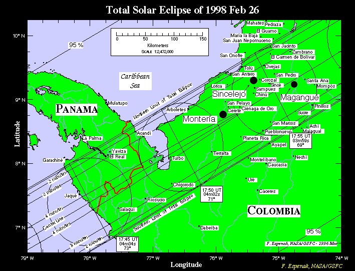
The path of totality has been plotted by hand on a set of ten detailed maps. The maps are Operational Navigation Charts or ONC's and have a scale of 1:1,000,000 (1 centimeter = 10 kilometers), which is adequate for showing major cities, highways, airports, rivers, bodies of water and basic topography required for eclipse expedition planning including site selection, transportation logistics and weather contingency strategies.
Northern and southern limits as well as the center line of the path are plotted along with the Universal Time, altitude of the Sun and the duration of totality. If observations from the graze zones are planned, then the zones of grazing eclipse must be plotted on higher scale maps using coordinates tabulated elswhere at this site.
These maps are adapted from NASA RP 1383 "Total Solar Eclipse of 1998 February 26".
It's been often said that a picture is worth a thousand words. If that's true, then you'll find the following 'pictures' of the 1998 eclipse very helpful. Would you like to see what the eclipse will look like from hundreds of cities around the world? If so, check out the following pages.
Please send your comments and suggestions to Fred Espenak

Eclipse Predictions & WebMaster: Fred Espenak e-mail: espenak@gsfc.nasa.gov Official NASA Representative: Dr. Drake Deming
Planetary Systems Branch - Code 693
|
|---|