A concise summary of all solar eclipses from 1931 through 1940 is presented in the table below. The first column gives the Calendar Date of the instant on greatest eclipse. The second column TD of Greatest Eclipse is the Terrestrial Dynamical Time when the axis of the Moon's shadow passes closest to Earth's center. The third column lists the Eclipse Type which is either Total, Annular, Hybrid[2] or Partial.
Eclipses recur over the Saros cycle, a period of approximately 18 years 11 days. Each eclipse belongs to the Saros Series shown in column 4. The Eclipse Magnitude[3] gives the fraction of the Sun's diameter obscured at the instant of greatest eclipse (column 5). For total and annular eclipses the Central Duration[4] gives the length of the eclipse as seen from the central line at greatest eclipse (column 6). Finally, the Geographic Region of Eclipse Visibility[5] provides a brief description of where each eclipse will be seen. Countries and regions within the path of total or annular eclipses are listed inside [ ] brackets.
Several fields in the summary table provide links to additional information and graphics for each eclipse. A map for an eclipse may be seen by clicking on the Calendar Date. The orthographic projection map of Earth shows the region of visibility for the eclipse. The path of the Moon's penumbral shadow (cyan and magenta) covers the region of partial eclipse. The track of the umbral or antumbral shadow (blue/red) defines the path of total or annular eclipse. These maps are described in greater detail in the Key to Solar Eclipse Maps. Each map is stored as a GIF of approximately 60 kilobytes.
The Eclipse Type link opens a new window with the central eclipse path plotted on an interactive Google Map. The northern and southern limits of the eclipse path are blue while the central line red. The yellow lines crossing the path indicate the position of maximum eclipse at 10-minute intervals. You can zoom into the map and turn the satellite view on or off. When you click on a position, the eclipse circumstances and times at that location are calculated and displayed.
All eclipses belonging to a particular Saros Series are listed in a table linked through the Saros number. Tables of geographic coordinates for the paths of all central eclipses (Total, Annular or Hybrid) are accessed by through the Central Duration. The tables include the northern and southern limits of the path as well as the central line.
The Key to Solar Eclipse Decade Table contains a more detailed description of each item in the table.
For more data on solar eclipses during this period, see Catalog of Solar Eclipses: 1901 to 2000 .
| Solar Eclipses: 1931 - 1940 | |||||||
| Calendar Date | TD of Greatest Eclipse | Eclipse Type | Saros Series | Eclipse Magnitude | Central Duration | Geographic Region of Eclipse Visibility | |
| (Link to Global Map) | (Link to Google Map) | (Link to Saros) | (Link to Path Table) | ||||
| 1931 Apr 18 | 00:45:35 | Partial | 147 | 0.511 | - | e Asia, n Canada, Greenland | |
| 1931 Sep 12 | 04:41:25 | Partial | 114 | 0.047 | - | Russia, Alaska | |
| 1931 Oct 11 | 12:55:40 | Partial | 152 | 0.901 | - | s S America, Antarctica | |
| 1932 Mar 07 | 07:55:51 | Annular | 119 | 0.928 | 05m19s | Antarctica, Australia, s Indies
[Annular: Antarctica, Tasmania] |
|
| 1932 Aug 31 | 20:03:41 | Total | 124 | 1.026 | 01m45s | N America, Russia, C America, n S America
[Total: Canada, U.S., North Atlantic] |
|
| 1933 Feb 24 | 12:46:39 | Annular | 129 | 0.984 | 01m32s | s S America, Africa, Antarctica
[Annular: Chile, Argentina, Congo, Zaire, C.A.R., Sudan, Ethiopia, Djibouti, Yemen] |
|
| 1933 Aug 21 | 05:49:11 | Annular | 134 | 0.980 | 02m04s | ne Africa, c Asia, Indies, Australia
[Annular: Middle East, Iran, Afghanistan, Pakistan, India, Myanmar, Indon., Australia] |
|
| 1934 Feb 14 | 00:38:42 | Total | 139 | 1.032 | 02m53s | e Asia, Australia, Alaska
[Total: Malaysia, Indonesia, central Pacific] |
|
| 1934 Aug 10 | 08:37:48 | Annular | 144 | 0.944 | 06m33s | s Africa, Antarctica,
[Annular: Angola, Nambia, Botswana, Zimbabwe, Zambia, Mozambique, S Africa] |
|
| 1935 Jan 05 | 05:35:46 | Partial | 111 | 0.001 | - | South Pacific | |
| 1935 Feb 03 | 16:16:20 | Partial | 149 | 0.739 | - | N America, C America | |
| 1935 Jun 30 | 19:59:47 | Partial | 116 | 0.338 | - | Russia, Canada, Greenland, n Europe | |
| 1935 Jul 30 | 09:16:28 | Partial | 154 | 0.231 | - | South Atlantic, Antarctica | |
| 1935 Dec 25 | 17:59:52 | Annular | 121 | 0.975 | 01m30s | Antarctica, s S America
[Annular: Antarctica] |
|
| 1936 Jun 19 | 05:20:31 | Total | 126 | 1.033 | 02m31s | Asia, e Europe, n Africa
[Total: Greece, Turkey, Russia, Japan] |
|
| 1936 Dec 13 | 23:28:12 | Annular | 131 | 0.935 | 07m25s | Australia, Antarctica, New Zealand
[Annular: Australia, New Zealand] |
|
| 1937 Jun 08 | 20:41:02 | Total | 136 | 1.075 | 07m04s | s N America, C America, nw S America
[Total: central Pacific, Peru] |
|
| 1937 Dec 02 | 23:05:46 | Annular | 141 | 0.918 | 12m00s | e Asia, w N America, e Indies
[Annular: central Pacific] |
|
| 1938 May 29 | 13:50:19 | Total | 146 | 1.055 | 04m05s | s S America, s Africa
[Total: South Atlantic] |
|
| 1938 Nov 21 | 23:52:26 | Partial | 151 | 0.778 | - | ne Asia, nw N America | |
| 1939 Apr 19 | 16:45:54 | Annular | 118 | 0.973 | 01m49s | N America, n Europe, Russia
[Annular: Alaska, Canada] |
|
| 1939 Oct 12 | 20:40:24 | Total | 123 | 1.027 | 01m32s | Antarctica, Australia, s S America, N.Z.
[Total: Antarctica] |
|
| 1940 Apr 07 | 20:21:21 | Annular | 128 | 0.939 | 07m30s | N America, C America, n S America,
[Annular: central Pacific, Mexico, U.S>] |
|
| 1940 Oct 01 | 12:44:06 | Total | 133 | 1.064 | 05m35s | S America, s Africa
[Total: Colombia, Venezuela, Brazil, South Africa] |
|
Geographic abbreviations (used above): n = north, s = south, e = east, w = west, c = central
[1] Greatest Eclipse is the instant when the distance between the Moon's shadow axis and Earth's center reaches a minimum.
[2] Hybrid eclipses are also known as annular/total eclipses. Such an eclipse is both total and annular along different sections of its umbral path.
[3] Eclipse magnitude is the fraction of the Sun's diameter obscured by the Moon. For annular eclipses, the eclipse magnitude is always less than 1. For total eclipses, the eclipse magnitude is always greater than or equal to 1. For both annular and total eclipses, the value listed is actually the ratio of diameters between the Moon and the Sun.
[4] Central Duration is the duration of a total or annular eclipse at Greatest Eclipse. Greatest Eclipse is the instant when the axis of the Moon's shadow passes closest to Earth's center.
[5] Geographic Region of Eclipse Visibility is the portion of Earth's surface where a partial eclipse can be seen. The central path of a total or annular eclipse covers a much smaller region of Earth and is described in brackets [].
Each link in the following table displays a page containing 10 years of eclipses. Every eclipse has links of global maps, interactive Google maps, animations, path coordinate tables, and saros tables.
| Decade Tables of Solar Eclipses | |||||
| Decades | |||||
|---|---|---|---|---|---|
| 1901-1910 | 1911-1920 | 1921-1930 | 1931-1940 | 1941-1950 | |
| 1951-1960 | 1961-1970 | 1971-1980 | 1981-1990 | 1991-2000 | |
| 2001-2010 | 2011-2020 | 2021-2030 | 2031-2040 | 2041-2050 | |
| 2051-2060 | 2061-2070 | 2071-2080 | 2081-2090 | 2091-2100 | |
Each of the following links displays a table containing 20 years of total, annular and hybrid eclipses. Each eclipse offers links to a global map, shadow animation, interactive Google map, path coordinates table, and saros table.
| Twenty Year Solar Eclipse Path Tables (w/Google Maps) | |||||
| Years | |||||
|---|---|---|---|---|---|
| 1901-1920 | 1921-1940 | 1941-1960 | 1961-1980 | 1981-2000 | |
| 2001-2020 | 2021-2040 | 2041-2060 | 2061-2080 | 2081-2100 | |
Each link in the following table displays a catalog containing 100 years of eclipses. Every eclipse has links of global maps and saros tables.
| Century Catalogs of Solar Eclipses | |||||
| Centuries | |||||
|---|---|---|---|---|---|
| 1001-1100 | 1101-1200 | 1201-1300 | 1301-1400 | 1401-1500 | |
| 1501-1600 | 1601-1700 | 1701-1800 | 1801-1900 | 1901-2000 | |
| 2001-2100 | 2101-2200 | 2201-2300 | 2301-2400 | 2401-2500 | |
| 2501-2600 | 2601-2700 | 2701-2800 | 2801-2900 | 2901-3000 | |
For other centuries, see Five Millennium Catalog of Solar Eclipses: -1999 to +3000
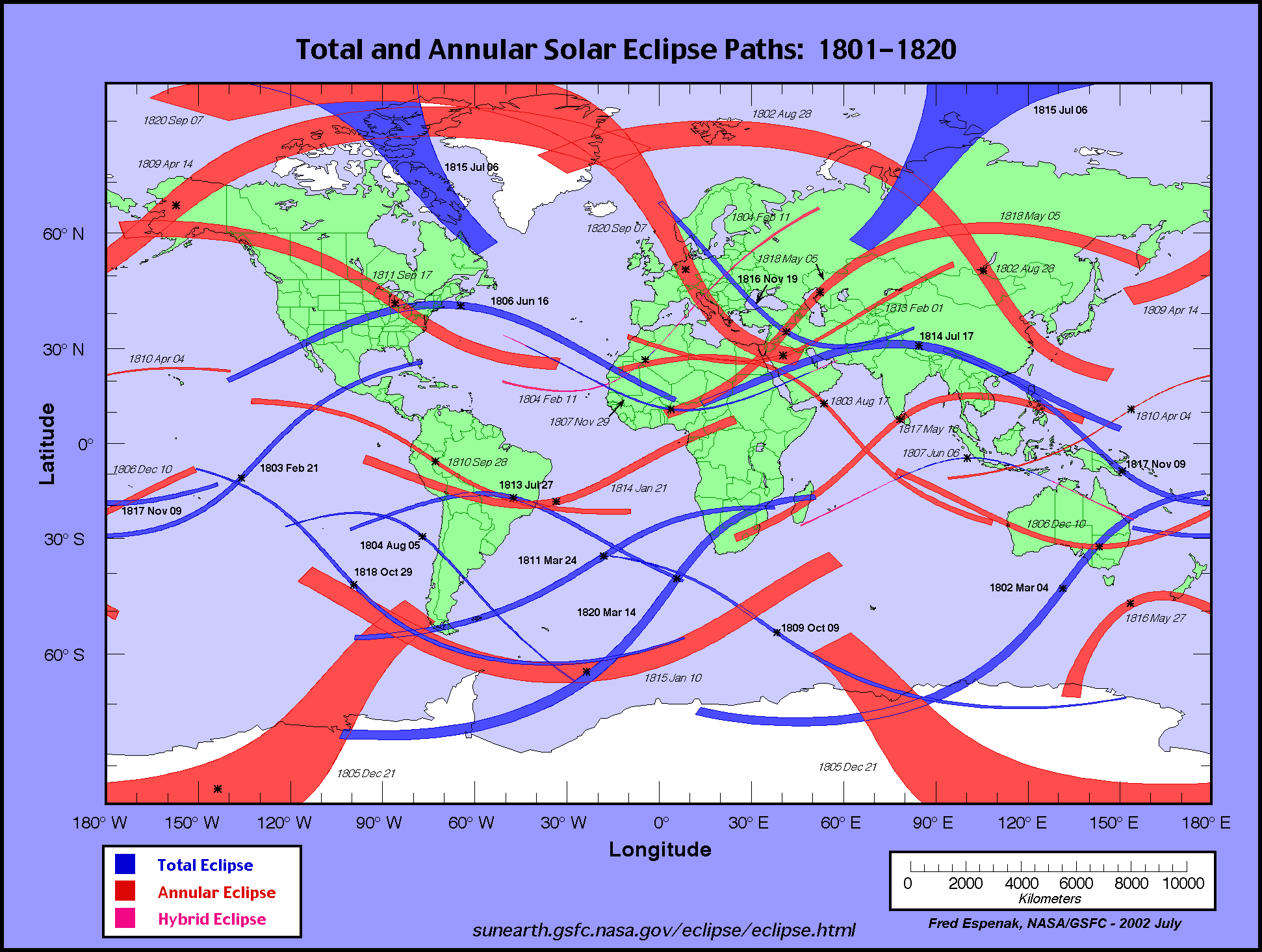
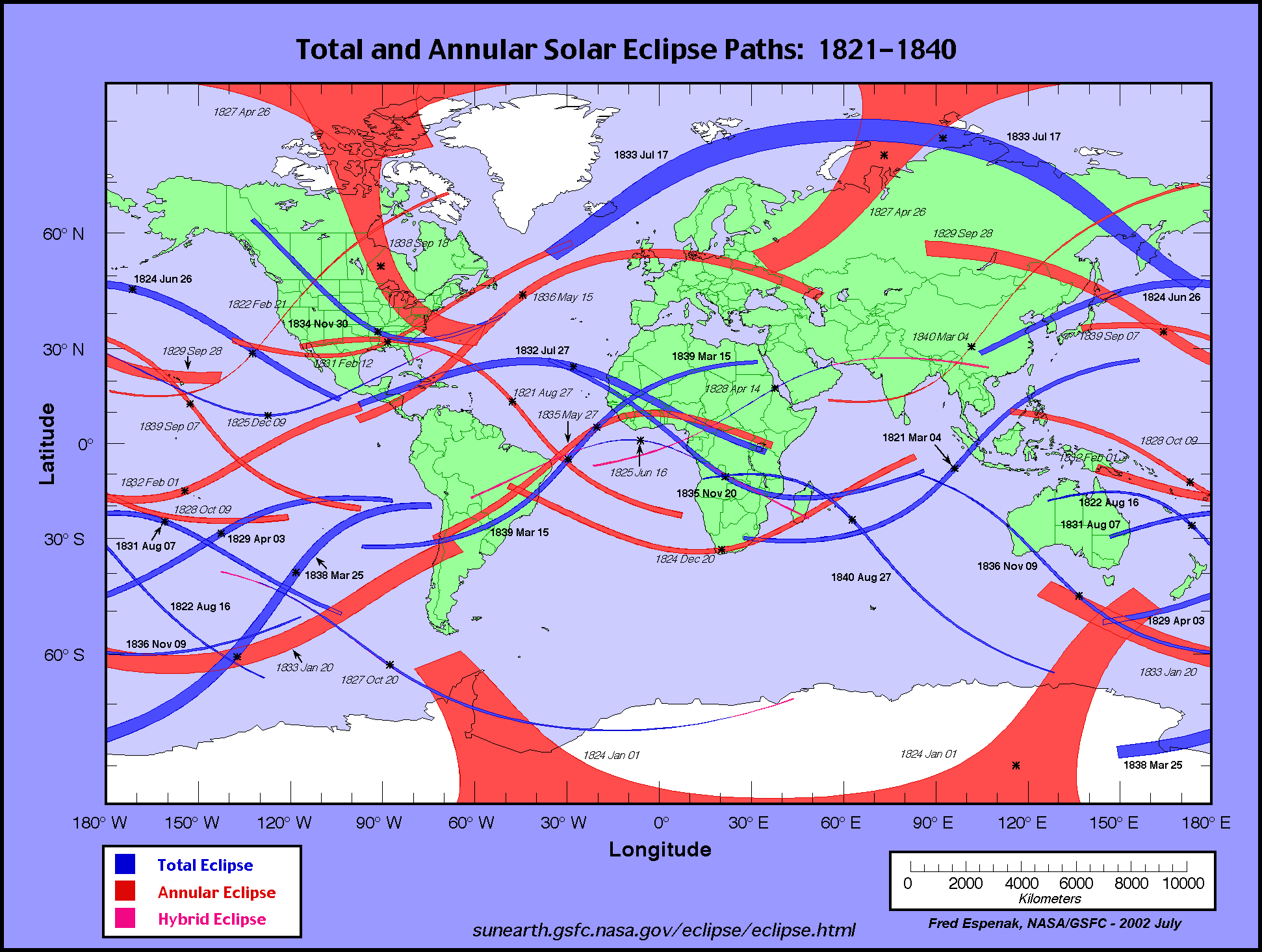
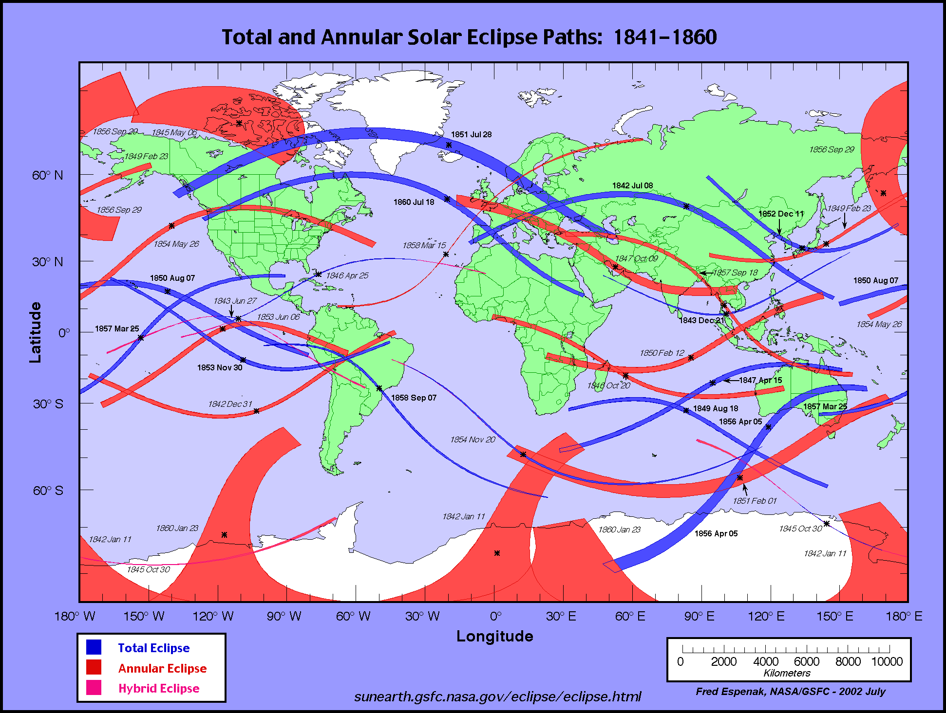
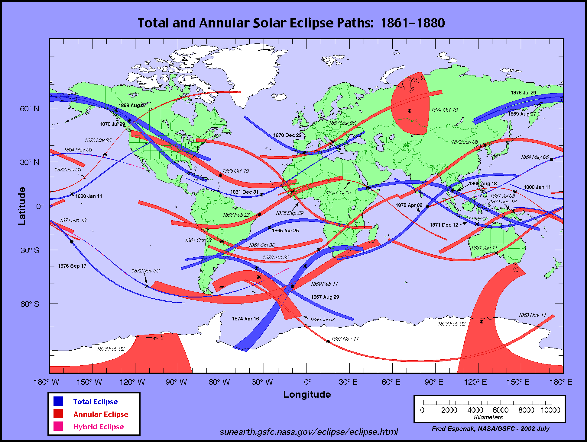
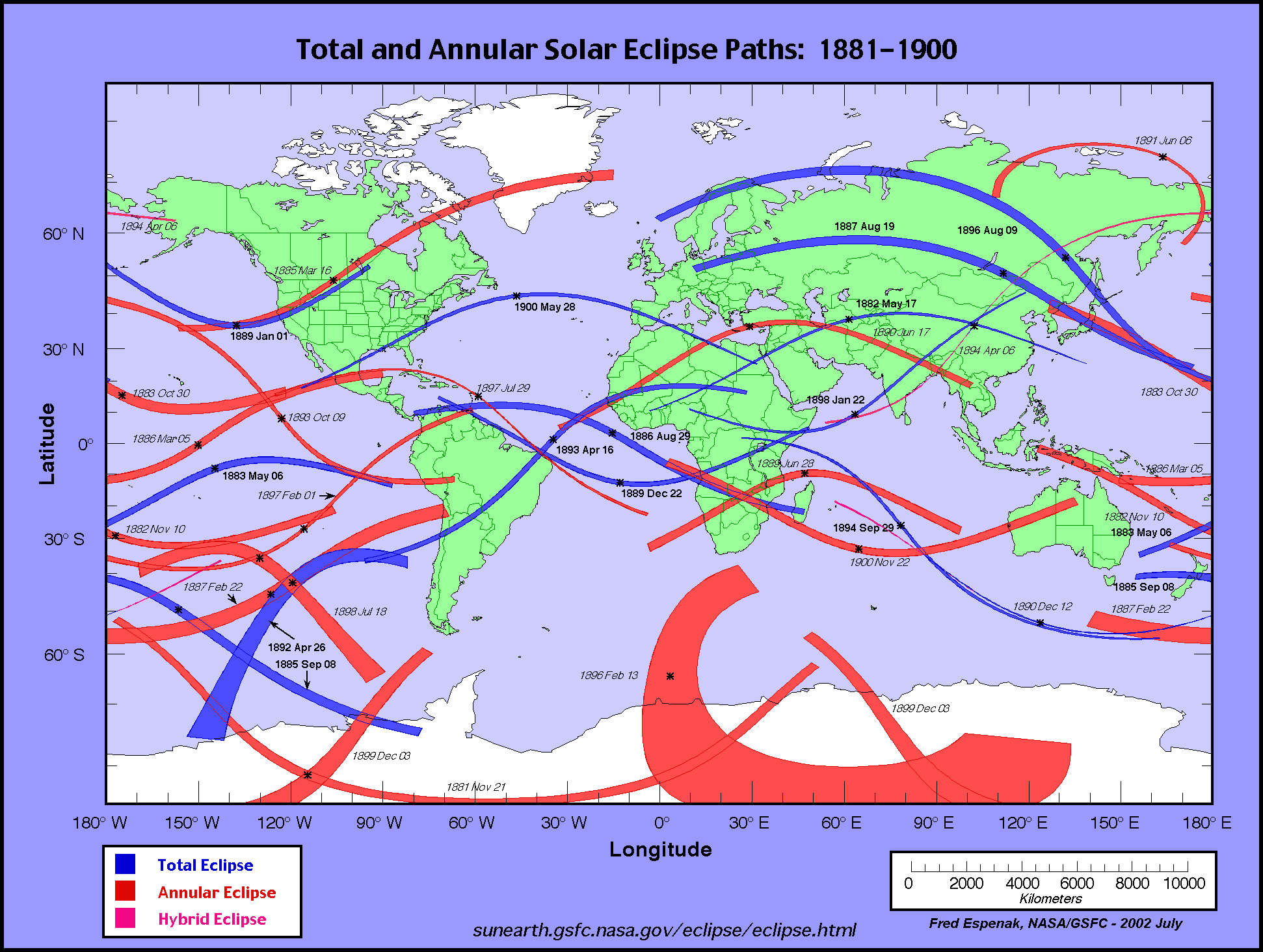
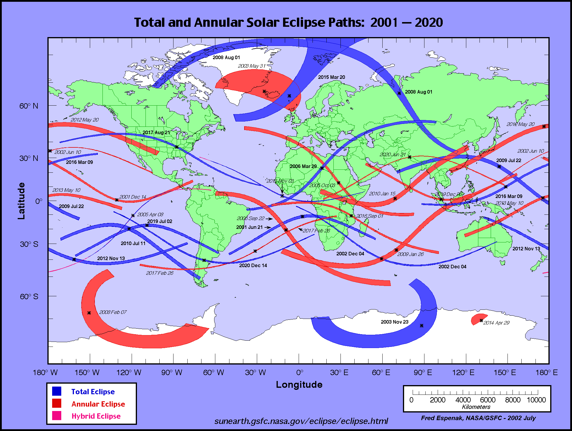
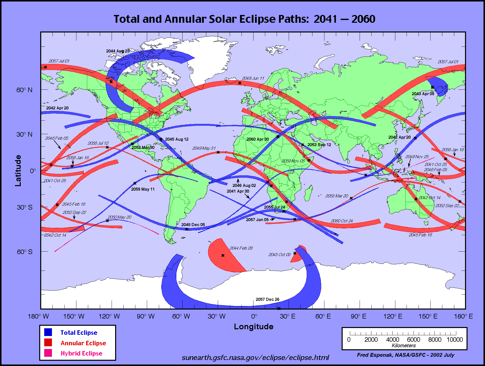
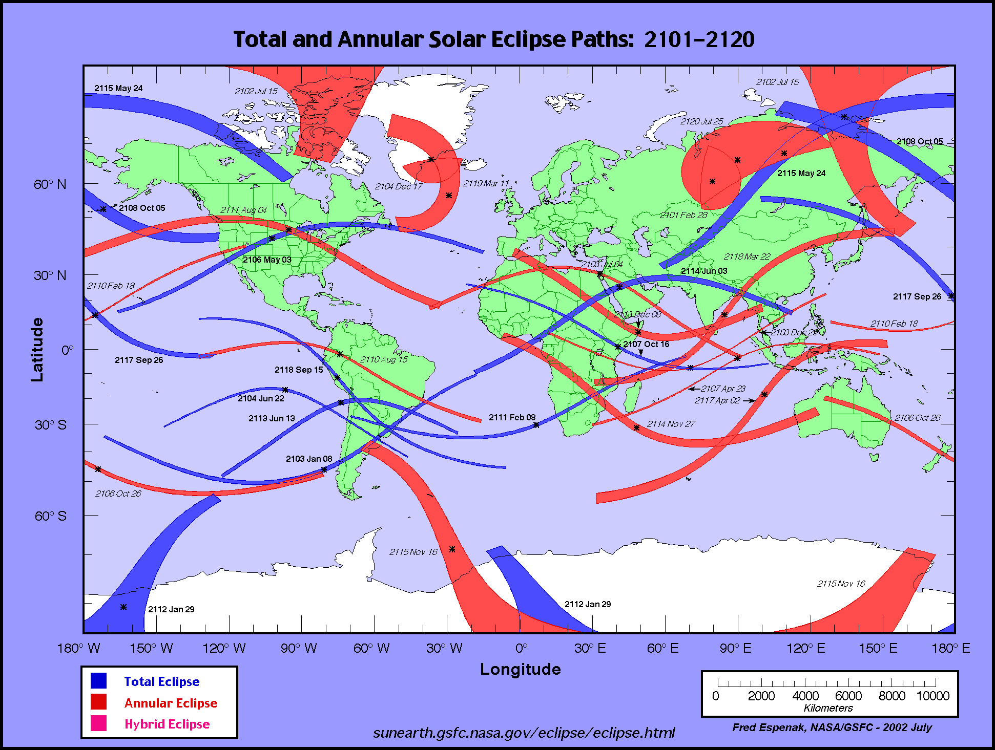
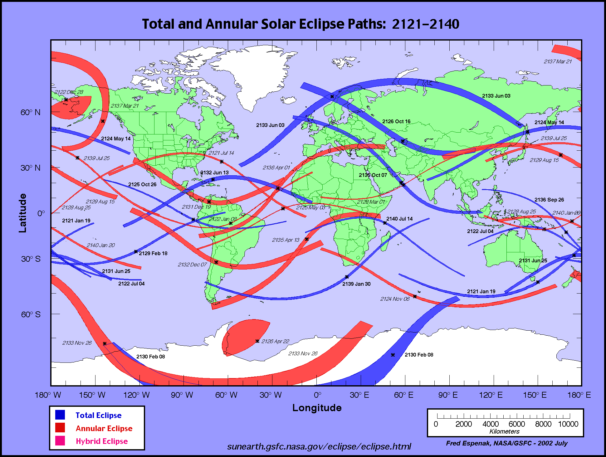
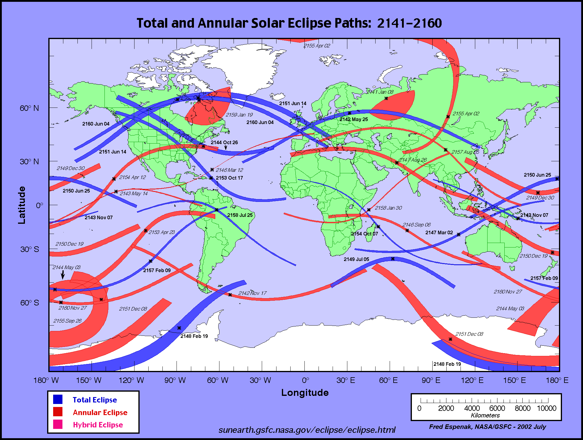
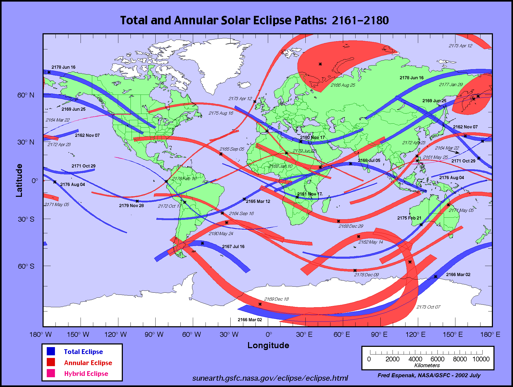
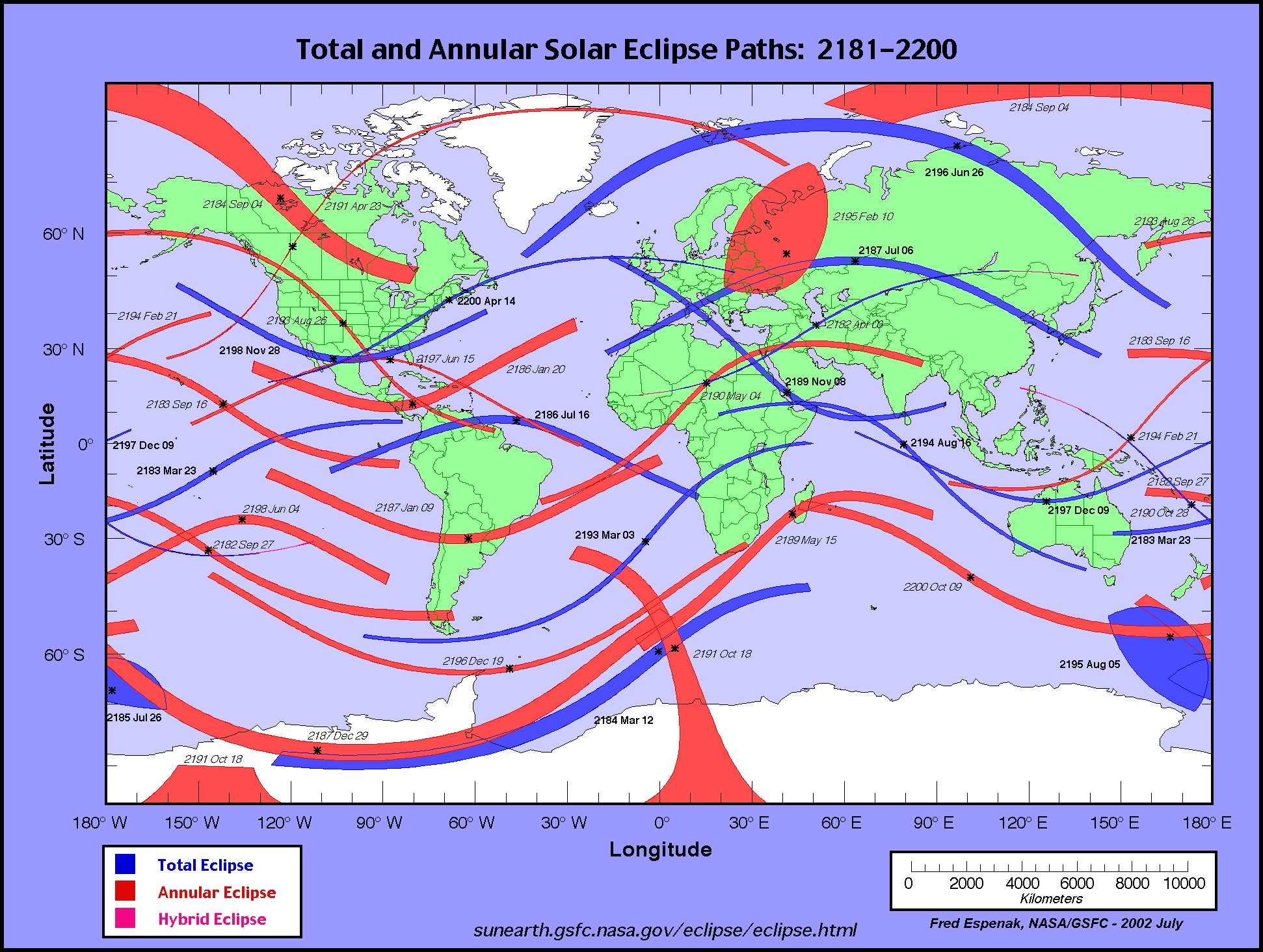
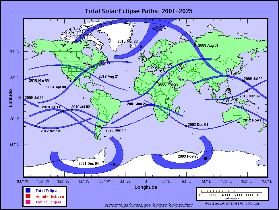
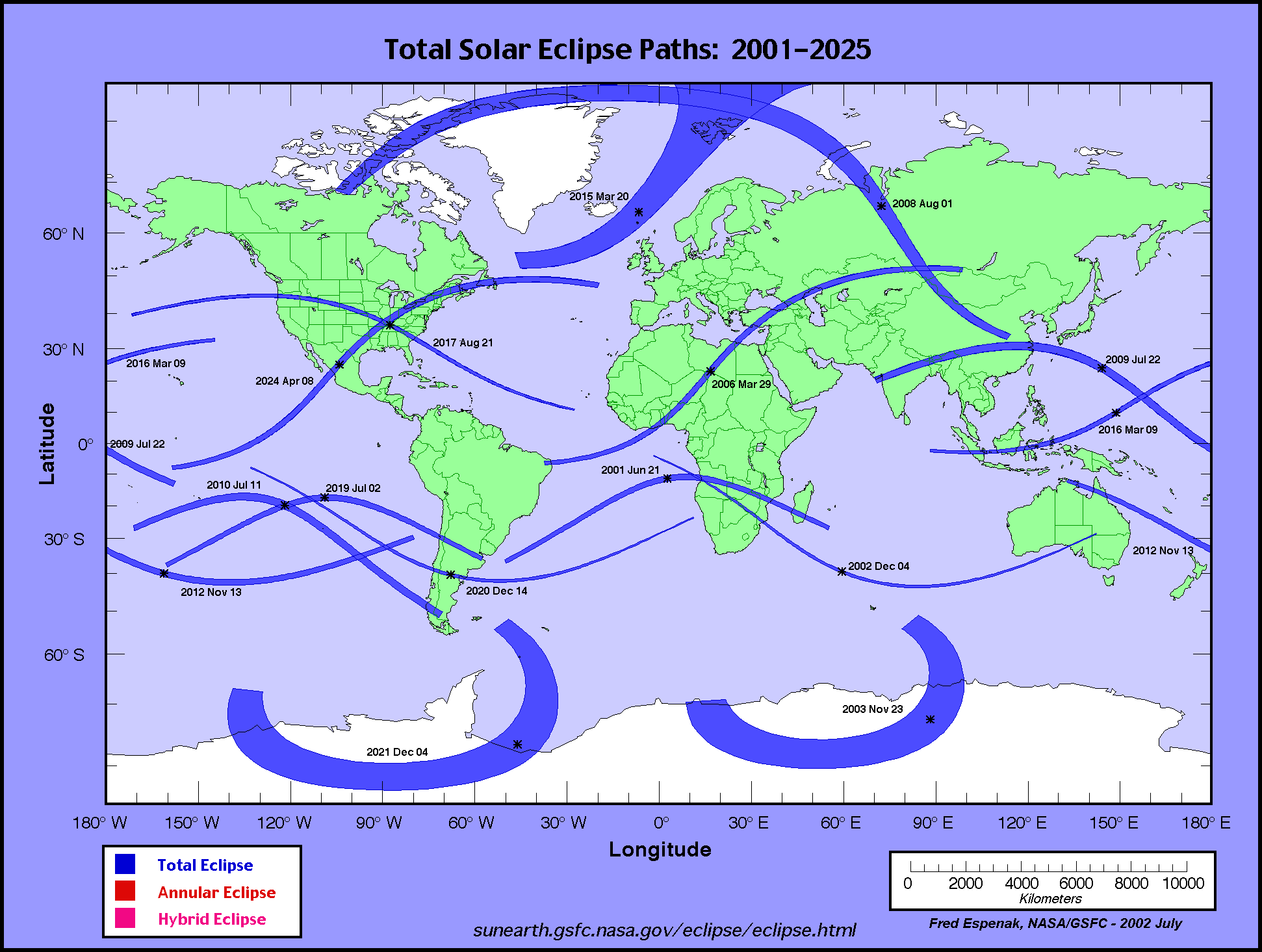
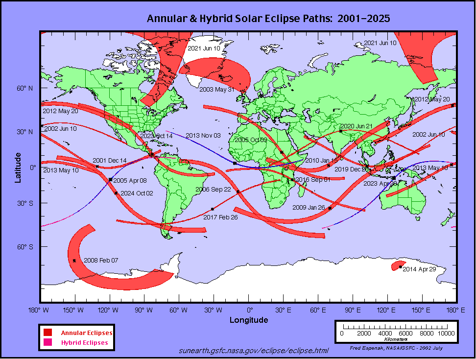
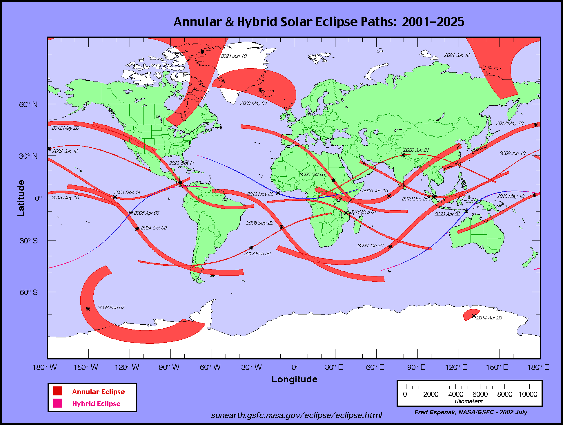
The World Atlas of Solar Eclipse Paths features maps showing the paths of all total, annular and hybrid eclipses. Each map in the atlas covers a 20-year period. The atlas spans five millennia from -1999 to +3000 (2000 BCE to 3000 CE).
| World Atlas of Solar Eclipse Paths | |||||
| 19th Century | 1801-1820 | 1821-1840 | 1841-1860 | 1861-1880 | 1881-1900 |
|---|---|---|---|---|---|
| 20th Century | 1901-1920 | 1921-1940 | 1941-1960 | 1961-1980 | 1981-2000 |
| 21st Century | 2001-2020 | 2021-2040 | 2041-2060 | 2061-2080 | 2081-2100 |
| 22nd Century | 2101-2120 | 2121-2140 | 2141-2160 | 2161-2180 | 2181-2200 |
For eclipse maps covering other decades, see World Atlas of Solar Eclipse Paths.
Special thanks to National Space Club summer intern Christopher Barrow for his valuable assistance in preparing the geographic visibility data (July 2004).
All eclipse calculations are by Fred Espenak, and he assumes full responsibility for their accuracy. Some of the information presented on this web site is based on data originally published in:
Fifty Year Canon of Solar Eclipses: 1986 - 2035
and
Five Millennium Canon of Solar Eclipses: -1999 to +3000 (2000 BCE to 3000 CE)
Permission is freely granted to reproduce this data when accompanied by an acknowledgment:
"Eclipse Predictions by Fred Espenak, NASA's GSFC"
For more information, see: NASA Copyright Information
